Geospatial Land Availability for Energy Systems (GLAES)
Geospatial Land Availability for Energy Systems (GLAES) is a framework for conducting land eligibility analyses and is designed to easily incorporate disparate geospatial information from a variety of sources into a unified solution.
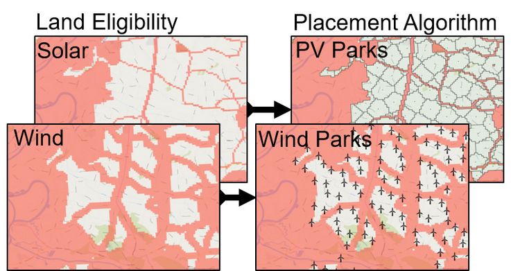
The main purpose of GLAES is performing land eligibility analyses which are used to determine areas within a region that are suitable for distributed renewable energy resources, such as onshore wind or open-field solar parks.
Open-Source available here.
Source: Ryberg DS, Robinius M, Stolten D. Methodological Framework for Determining the Land Eligibility of Renewable Energy Sources. arXiv:1712.07840 [cs.OH] 2017.