Digital Leader Award
"It makes us really proud"
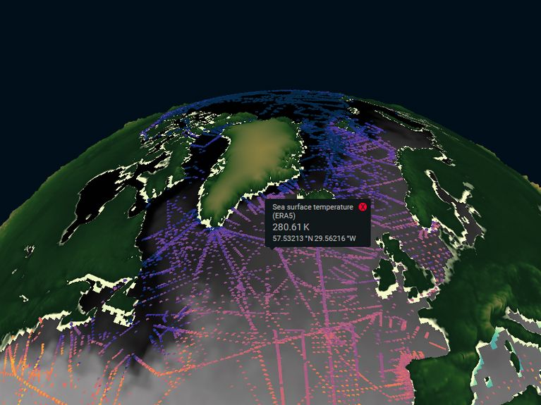
In the Digital Earth Viewer, simulation and measurement data can be explored and compared interactively, geographically and temporally. Image: GEOMAR
In the Digital Earth project, geoscientists and computer scientists want to better understand the Earth system using data scientific methods. The project has now been awarded the prestigious Digital Leader Award. We spoke to one of the researchers involved.
How does it feel to receive this prestigious award?
We think it's great, also for our young scientists, who are advancing the project with so much commitment. It shows that all our efforts to implement this interdisciplinary project are worthwhile. Industry is ahead of science in terms of digitization in some fields. We are therefore pleased that we were able to prevail in the final round of the competition, even against well-known companies from industry. That makes us really proud.
What exactly is "Digital Earth" and what is it for?
The goal of the project is to further develop data-driven geoscientific research with the help of new approaches from computer science and data science, in order to be able to work on and answer complex geoscientific questions across disciplines. Digital Earth is a project of all eight Helmholtz Centres in the field of Earth and Environment. Data, methods and results are to be shared, combined and explored across disciplinary boundaries. We want to develop solutions for this.
How does the project team approach this?
It starts with the composition of the team: We work on an interdisciplinary basis, otherwise our project would not succeed. In our team, geoscientists from different research areas, computer scientists and data scientists work closely together. We combine methods from statistics, machine learning, visualization, interactive data exploration and software development and use them to design new approaches and tools.
Do geoscientists and computer scientists differ very much in the way they work?
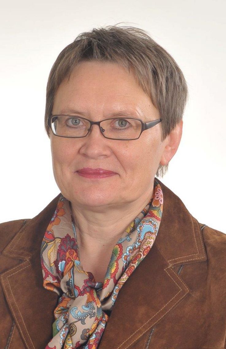
Prof. Dr. Doris Dransch is head of the sectionRemote Sensing and Geoinformatics at Helmholtz Centre Potsdam - German Research Centre for Geosciences GFZ
Yes, geoscientists work in a strongly application-oriented way, whereas computer scientists work in a very formal way. This is a great challenge that has to be met. We use the concept of workflows for this. For this, the geoscientists have to present their working methods transparently and document them as a scientific workflow. The computer scientists can then convert this into a digital workflow. But that doesn't mean that one person writes it down and the other receives it. That would not work. Instead, we are in a permanent exchange, in permanent communication.
If you want to analyze data, you naturally need methods. What about the technical side?
Many scientists develop methods for data analysis and write their individual evaluation routines. These methods have to be made available to other scientists and they have to be able to be integrated into larger analysis chains - into digital workflows. To make this possible, we have developed a component-based software framework that forms the basis for all software developments in Digital Earth.
That sounds like a mammoth project. Do you feel the same way or do you just take many small steps one after the other?
Digital Earth is a large, complex and also challenging project. It takes many steps and a lot of coordination to achieve the goal. But our enthusiasm is what drives us: The goal of scientists is to find out something new, and to do that they have to break new ground. These are usually always challenging.
How do you proceed?
Our working method is very structured: We work on two exemplary case studies, the investigation of flood events and their effects on the environment and society, and the quantification of climate-damaging methane emissions. We proceed according to a defined methodology and adapt established approaches from geosciences, computer science and data science. We continuously exchange information and evaluate our project work in order to identify potential for improvement.
How many people are involved in Digital Earth?
The number of active employees is around 50, around 40 percent of whom are young scientists. The gender balance is also almost even, which is not a matter of course in our MINT area. The collaboration of so many different employees requires a lot of discussion, which is conducted with great passion and sometimes a bit heatedly. In the end, there is always a good result.
How did you find a common language?
We quickly realized that the various disciplines have a very different vocabulary. Bringing them together was an important learning and finding process. The various geosciences, computer science and data science, each discipline lives in its own conceptual world. Even if you have the same word, the semantics are different. To develop a common language so that we understand each other, that's what made the project so special.
Not every scientist gets involved in this ...
Right. This requires a certain type of scientist who wants to develop something new in the intersection of different disciplines, who wants to get involved in other disciplines and build a bridge to them. Our young scientists are enthusiastic bridge builders. But even the old hands say: "In no other project have I learned so much as in this one.
The project is still limited to eight Helmholtz Centres. So should what works at Helmholtz be rolled out on a larger scale?
Precisely. We started out at Helmholtz, but have already established close links with national projects that are embedded internationally. One example of this is the National Research Data Infrastructure (NFDI) project, with which there are already very good links. We are holding talks about possible collaborations and exchanging technologies.
How long did it take from the initial planning stage until the whole thing started to take off?
That was a long process. The directors of the Helmholtz Centres in the Earth and Environment Division approached us with the idea of further developing data-driven research using new approaches from computer science and data science, away from the individual disciplines and towards a cross-disciplinary overall understanding of System Earth. The beginning of the project was very difficult because there were such different ideas: IT infrastructure managers, geoscientists, computer scientists, everyone contributed their ideas, and it was a challenge to develop a joint project proposal from the many-voiced choir. But because we absolutely wanted it, we succeeded. We are now in our third year, and the lead time was certainly another two years. In the meantime we have shown by means of the case studies
Digital Earth
Climate change and its consequences, risks from earthquakes or flooding, sustainable use of resources, biodiversity: these are all topics that are increasingly preoccupying our society. In order for science to provide reliable information, scientists must understand the complex processes of the Earth system and the influence of humans. This requires research approaches that are not limited to individual disciplines but open up a holistic, "holistic" approach. Scientific working environments are required that enable the sharing, combining and exploring of scientific data, methods and results across disciplines. The goal of Digital Earth is to develop, test and demonstrate such new cross-disciplinary digital working environments using approaches from computer science and data science.
On September 10, 2020, the Digital Earth project was awarded the special prize for "Digital Science" of the "Digital Leader Awards" in the "Society" category. With these awards, NTT and IDG Business Media recognize projects and teams that drive the digital transformation across industries.
Participating Helmholtz Centres:
- Alfred-Wegener-Institut Helmholtz-Zentrum für Polar- und Meeresforschung Bremerhaven
- Forschungszentrum Jülich
- GEOMAR Helmholtz-Zentrum für Ozeanforschung Kiel
- Helmholtz-Zentrum Potsdam Deutsches GeoForschungsZentrum
- Helmholtz-Zentrum Geesthacht
- Helmholtz-Zentrum München
- Karlsruhe Institut für Technologie
- Helmholtz-Zentrum für Umweltforschung


Readers comments